
Lead Mines Clough Lead Mines
Named Mineral Veins found at Lead Mines Clough
The mines in Lead Mines Clough worked several mineral veins that are based around major geological faults and minor cracks or fissures radiating out from them. The names are arbitrary and were probably given by the miners of the time.Chorley Road Vein
An extension of the Brinscall Fault from which many of the smaller veins issue.Old or Sun Vein
A large vein which was probably the first worked in the area. The miners in the 1780s refer to The Old Man - an earlier, mined-out working on the Sun Vein.String Vein, Mine House Vein and Engine Vein
Smaller mineral veins joining the larger veins described above. Mine House and Engine are named for the site of the Mine House at Staple Shaft which went down onto the vein and the Old Engine Shaft respectively - both located on the South side of the Limestone Brook.Hammerton Vein
A substantial looking mineral vein crossing the river below Meeting of the Waters and not mentioned much in the records.New Tryal Vein
A mineral vein discovered further upstream which the 1780s miners were optimistic about, but hadn't worked. It doesn't seem to have lived up to their expectations or those of Thompson years later.Mine Shafts at Lead Mines Clough
As described, the area around the Limestone Brook, just above its confluence with the water from Twitchills Clough - which seems to have been artificially re-routed to either clear water from the area or more likely to drive a waterwheel upstream - is peppered with old shafts and spoil heaps. Incidentally, a section of the Limestone Brook has been relocated from this area down to the bridge near the confluence with the Yarrow. This was probably done at the time of the construction of the Yarrow Reservoir. The original course can be seen as a grass-covered channel to the East of the current footpath. The gravel footpath and bridge being relatively modern features that replaced an earlier ford. With this in mind, together with Thompson's later working which has probably obliterated many of the older features it is very difficult to discern the exact location of the main shafts today - although several following the Sun Vein are easily delineated from the mounds above ground. The position where the Brinscall Fault and therefore the Chorley Road Vein cross the brook is indicated by the small waterfall and Marine Band, upstream from the first bridge.Old Engine Shaft
A shaft on the Engine Vein, located on the South side of the brook before the steep hillside (now modified by spoil and the zig-zag track which is relatively recent). Engine Vein connects to both the Chorley Road Vein and Sun Vein.Staples Shaft
Another shaft beside the brook, upstream from the Old Engine Shaft. Staples shaft went down onto the Minehouse Vein which also connects the Chorley Road Vein and Sun Vein. Old maps show a ruin here which was perhaps the titular mine house.New Engine Shaft
New Engine Shaft was sunk onto the Sun Vein, close to where it intersects the Chorley Road Vein. The shaft was located on the high-ground to the south of the brook. The strata identified from the top-down in New Engine Shaft was given by the Overlooker of the mine (note the archaic use of 'f' for 's') during Watt's visit was:- 1/2 yard loofe Stones and Sand.
- 7 and 1/2 yards Sand-ftone.
- 1/2 yard Argillaceous Shiftus and Coal.
- 1 yard Argillaceous Shiftus.
- 16 yards Sand-ftone.
- 16 and 1/2 yards Argillaceous Shiftus.
Old Forefield and New Forfield Shafts
Two shafts to the East of lead mines clough on the Sun Vein and distinguishable on the ground for their mounds that remain on the surface.Sun Vein Minerals
Due to the New Engine Shaft we are able to learn a bit about the contents of the Sun Vein and their relation to the other nearby mineral veins. Warning: Some of the minerals found at lead mines clough may be poisonous so it's a good idea not to smash the rocks up which may cause airborne dust, and certainly don't ingest any. As always, wash your hands!Iron
Disregarding the glacial till which can contain all manner of rock brought down by the glaciers and churned around in the soil since; we are told from Watt's account that 'laminae of Martial Pyrites', are found between the shale and this is easily verified for much of the shale seen above ground today is covered with hydrated FeO3 oxide or 'Ochre' as it is commonly called here indicating the oxide formed from the iron.Witherite
First differentiated from Barite by Dr. Withering who called it Terra Ponderosa Aerated. Witherite is a form of Barite that contains trapped Oxygen. Barite is often associated with lead ore in mineral veins; Witherite is relatively rare and not found at many sites where Barite is present. It was reported by the 1780s miners that the Witherite is most abundant higher in the mineral vein and that it is replaced by Barite in greater amounts as depth from the surface increases. Further, the greatest concentrations of Galena or lead ore are found associated with the Witherite and are lost towards the bottom of the shaft where Barite is most prominent.Barite
Barite is commonly associated with lead ore and is found here in various forms from tiny crystals and coxcomb to massive Barite Spar or Heavy Spar as it was known. As described the quantity of Barite increases with relation to the Witherite as depth increases.Galena
The lead ore or Blue Lead that was the purpose of the mine occurs mostly in association with the Witherite and was found to decrease to nothing by the depth of the bottom of the New Engine Shaft. Watt tells us that the Galena is found together with 'Blende and Black Jack'. Despite Thompson's assertion that he found not a pound, it is still relatively easily to find small quantities in spoil from the mines today.Sphalerite
Black Jack or Zinc Blende is Sphalerite, another mineral often found in association with lead ore. However, note that miners are known to have used 'Black-Jack' to refer to Cannel Coal, while 'Coal Blende', is another term used to describe coal found together with Iron Pyrite - which are also present here.Calcite
A further, unnamed shaft was sunk underground, from a side tunnel off the Chorley Road Vein and adjacent to the New Engine Shaft for a further 11 yards (10m) which cut through two or three small beds of bluish sandstone and a small quantity of 'Calcareous Spar' which we know as Calcite.Cannel Coal
Coal seams occur within the strata and the most prized was the Cannel or 'candle' coal which is a mid-grade coal, somewhere between bituminous coal and oil shale. Cannel coal burns with a bright flame and produces little ash, it was also used to produce Cannel Gas, which was an early domestic supply. Cannel is formed from an accumulation of oils and pollen type material from plants rather than plant stems and the like which form the other coals found nearby. Cannel is solid enough to be carved and polished into ornaments and jewellery, similar to Whitby Jet.Lead Mines Clough Adits
There have been several known adits associated with the lead mines but most are now blocked and concealed for safety. There are a few small or obscured features around the brook with suspect, orange ochre leaching into the water that are probably connected to the mines.High Level Sough
A drainage tunnel from the higher levels of the mine (those above the level of the sough and therefore contained within the high ground to the east) that has been displayed with a marker since the early 80s after the mining remains were restored.Low Level Sough
A drainage tunnel for the lower levels, deep underground. The pump shaft that is visible below the waterwheel pit would have pumped the water up to a small tunnel which allowed the water to flow into the brook. Bill Jones (Bolton's Industrial Heritage) has this connected to the South Level during the driving of the level, but recall Gill says that particular waterwheel belongs to a later time - probably that of Thompson in the mid-to-late 1820s.South Level
The South Level was driven during Frank Standish's time and described in Watt's visit as having been driven from the bottom of the New Engine Shaft at a depth of 38.4 metres. On the Overlooker's map the level is shown extended northwards to meet Minehouse Vein, near to Staple shaft. In the southerly direction the level heads off the bottom of the map towards where Yarrow Reservoir is situated today. We are told in Watt's report that at the time of his visit (around 1789) that all the mines now drain via South Level, except where the extended 11 yard shaft mentioned previously took mining down that extra distance looking to find out if the ore returned at greater depth. This was said to have been cleared using a small pump which was driven by a waterwheel in the valley above. I am not sure of the mechanism but presumably the water would have only been pumped the 11 yards and then allowed to drain via the South Level. As briefly mentioned Gill calculates by taking 38.4 metres from ground level in the clough, indicating the South Level would emerge around the 150 metre contour (I tried myself and calculated 156.6 metres). Land at this height is not encountered until around the site of old Alance at the bottom of the valley which was the nearest settlement. However, the direction of the South Level appears to be heading further to the east of Alance. Interestingly, the 'Minehouse' is shown as a ruin on the old maps and another ruin of very similar size and shape is shown below Anderton's farm on the north shore of Yarrow Reservoir which is at around 167.64 metres. A small dotted line is shown leading downslope to a rectilinear feature just on the 500ft contour (which is 152.4 metres). Otherwise, like M.C. Gill we can only assume the level adit was covered during construction of the reservoir. To avoid confusion, note that there is a stone-lined tunnel very close by which is not related to the mines and is used to carry water off the Dean Brook above the waterfall and into the reservoir. It is erroneously marked as Dean Brook Tunnel Inlet on some maps (it's an outlet). Bill Jones has a sough leading from the South Level out onto the Limestone Brook above Meeting of the Waters in his self-penned diagram, but as we have seen, this would be many metres above the South Level. We know the South Level once had an entrance portal at ground level because we are told that production from the mines increased from 4 tonnes a year to 73 tonnes over next 3 years due to the South Level having been driven. This meant ore could be taken out of the mines through the South Level adit rather than hauling it up the mine shafts on the hill. We are also informed that all the mines drained into the South Level after its completion so it must not at any time travel uphill from it's starting point, 38.4 metres below ground at the New Engine Shaft.Lead Mines Clough Lead Mines Postcode:
England > Lancashire > Chorley > Chorley > Anglezarke > Lead Mines Clough > Lead Mines Clough Lead Mines

Trial Shaft on the Hammerton Vein above Lead Mines Clough

Higher Level Sough Covered Tunnel Entrance
 further up the Limestone Brook")
Ochre (hydrated Fe03 oxide) further up the Limestone Brook

Inside a nearby lead mine trial

Slime Pit at Lead Mines Clough

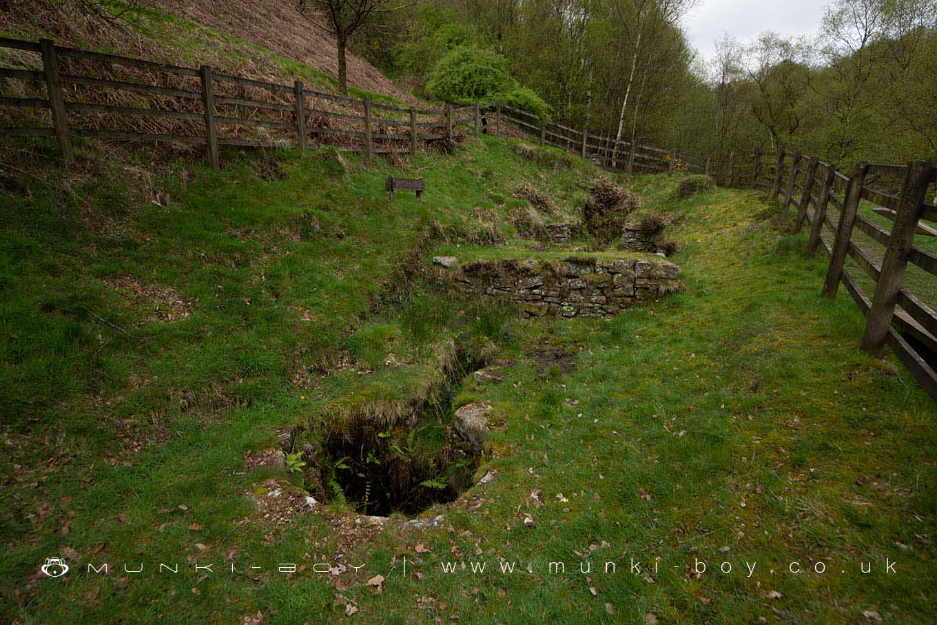
Old mine shafts in the woods near the bottom of Lead Mines Clough

Old Course of the Limestone Brook at Lead Mines Clough

Near the site of New Engine Shaft at Lead Mines Clough

Spoil Heaps from the Sun Vein at Lead Mines Clough

Possibly Bill Jones' Suggested Sough from the South Level near Meeting of the Waters at Lead Mines Clough

Shale with iron oxide from Pyrites at Lead Mines Clough

Witherite from Lead Mines Clough

Barite from Lead Mines Clough

Galena on Witherite from Lead Mines Clough

Blue Lead Ore from Lead Mines Clough

Lead Ore from Lead Mines Clough

Barite with Iron Staining from Lead Mines Clough

Barite / Witherite from Lead Mines Clough

Barite Spar from Lead Mines Clough

Copper on Galena Lead Mines Clough

Lead and Copper from Lead Mines Clough

Barite / Witherite and Galena Lead Mines Clough

Barite Spar Lead Mines Clough

Ankerite Lead Mines Clough

Marcasite and Galena on Barite Lead Mines Clough

Marcasite on Barite Lead Mines Clough

Sphalerite and Barite Lead Mines Clough

Sphalerite and Witherite Lead Mines Clough

Black Jack Sphalerite And Barite Lead Mines Clough

Mine Overlooker's Map of Lead Mines Clough - circa 1789